How Big Is Oahu? Island Size, Miles & Drive Time
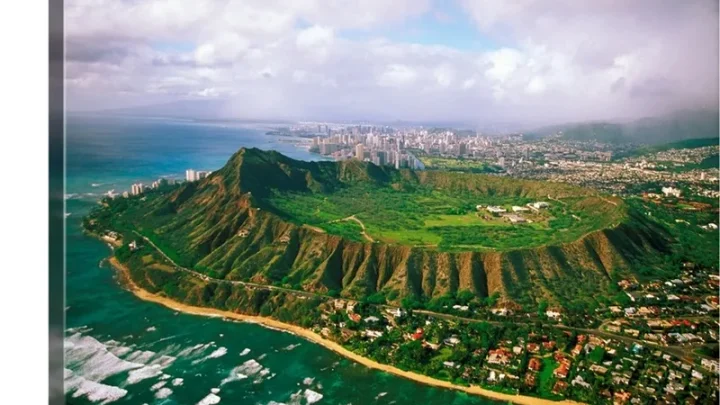
Planning a trip across Hawaii often starts with one practical question: what is the size of Oahu? Looking at a standard map can be deceiving. The island looks small on paper, yet its dramatic terrain creates distinct regions that feel worlds apart.
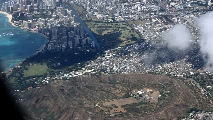
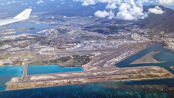
Official data from the U.S. Geological Survey confirms that Oahu covers roughly 597 square miles of total land area. That compact footprint holds over two-thirds of Hawaii's entire population along with several distinct climate zones.
Understanding these true dimensions helps you plan realistic drive times and better daily itineraries.
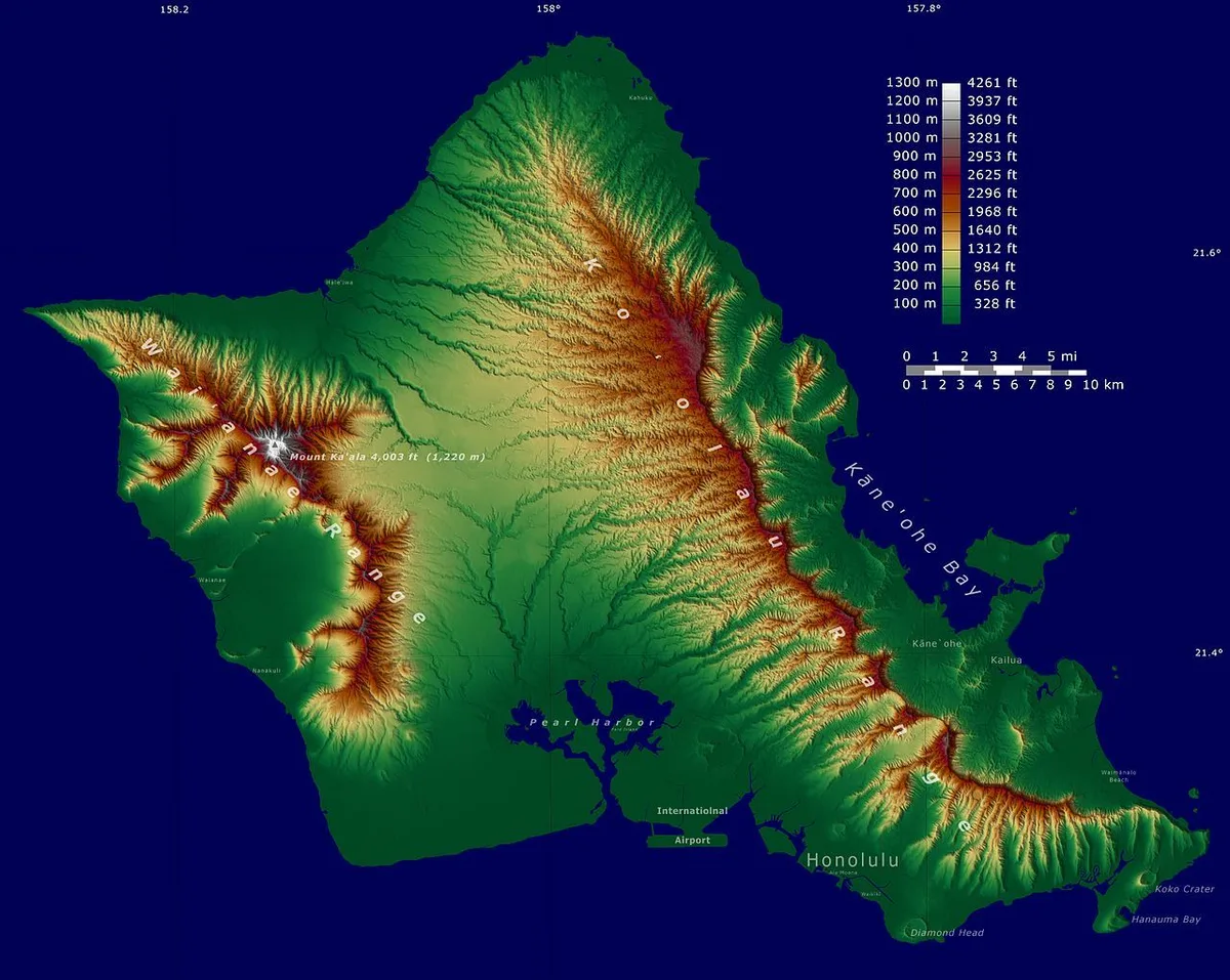
Image source: Web (Bing) / pinterest.com (Web image (fair-use with source credit))
Quick Answer
People often ask what is the size of Oahu. The island spans 597 square miles. It measures 44 miles long and 30 miles wide.
The coastline stretches for 227 miles. Oahu is the third-largest Hawaiian island by area. A complete driving loop takes four to six hours.
Exact Dimensions: Land Area, Width, and Shoreline Perimeter of Oahu
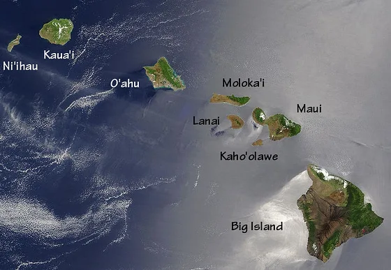
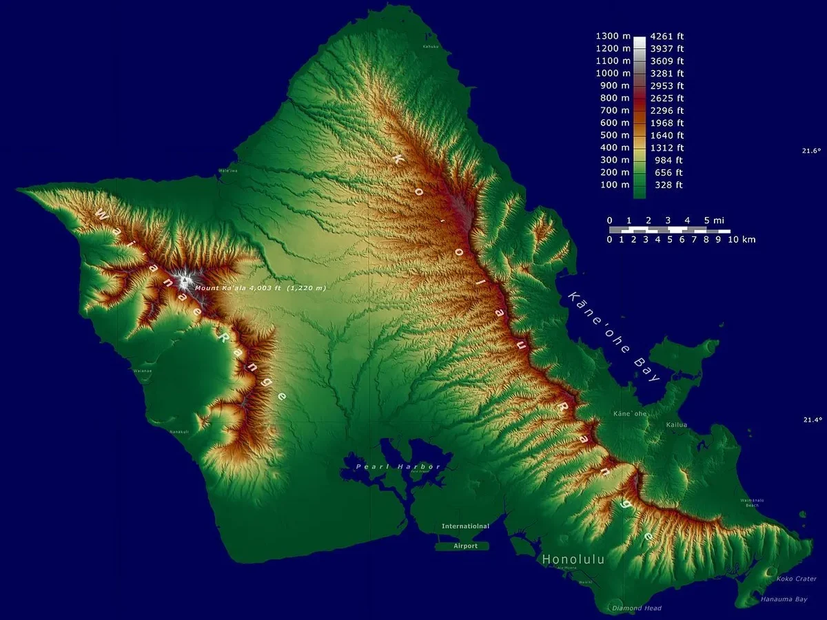
Oahu ranks as the third-largest island in the Hawaiian chain, sitting behind the Big Island and Maui. The island encompasses 596.7 square miles (1,545 square kilometers) of land. From its northernmost point at Kahuku Point to its southern edge near Makapuʻu, the island measures roughly 44 miles long.
At its widest point from west to east, Oahu stretches approximately 30 miles across. The total shoreline perimeter measures 227 miles, lined with sandy beaches, sea cliffs, and coastal reef flats.
| Geographic Metric | Official Measurement (Imperial) | Official Measurement (Metric) |
|---|---|---|
| Total Land Area | 596.7 sq miles | 1,545.6 sq km |
| Maximum Length | 44 miles | 70.8 km |
| Maximum Width | 30 miles | 48.3 km |
| Coastline Length | 227 miles | 365.3 km |
| Highest Elevation | 4,025 feet (Mount Kaʻala) | 1,227 meters |
| Second Highest Peak | 3,150 feet (Puʻu Konahuanui) | 960 meters |
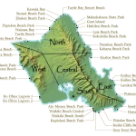
These physical boundaries contain roughly 110 to 120 miles of drivable perimeter highway. You can see the ocean from many high vantage points, but rugged interior peaks prevent any direct straight-line travel across the center.
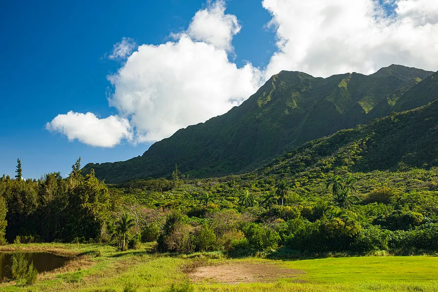
Image source: Web (Bing) / body.lcpm12.org (Web image (fair-use with source credit))
Reading the Island Map: Why Mountain Ridges Make Oahu Feel Twice as Big
If Oahu were flat, you could drive across it in thirty minutes. Instead, the island feels vast because two massive, parallel mountain ranges block east-west movement. These ranges force all road traffic into specific highway corridors and coastal choke points.
The Twin Shield Volcanoes: Koʻolau and Waiʻanae Ranges
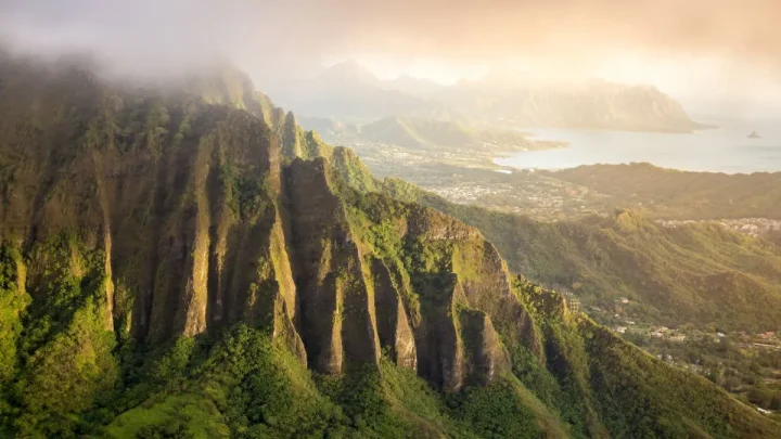
Two extinct shield volcanoes formed Oahu millions of years ago. The Waiʻanae Range anchors the western side of the island, rising to 4,025 feet at Mount Kaʻala. The Koʻolau Range runs along the eastern side, featuring steep, corrugated green cliffs known as the Pali.
No public paved roads cross directly over the high peaks of the Waiʻanae Range. Because of this wall of rock, traveling between the Leeward Coast and Central Oahu requires looping all the way around the southern tip near Kapolei.
The Kaʻena Point Dead End: Why You Cannot Drive in a Complete Circle
Many first-time visitors look at a map and plan a simple 360-degree perimeter loop. That is physically impossible by car. The far northwestern tip, known as Kaʻena Point, is a protected natural area with jagged volcanic coastline and sand dunes.
Farrington Highway dead-ends on the west side near Yokohama Bay. It also dead-ends on the north side past Mokulēʻia. To get from the west coast to the North Shore, you must backtrack south toward Pearl City before heading north through the central valley.
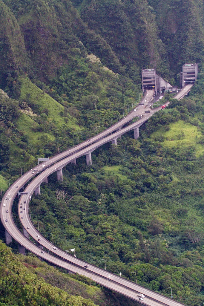
Image source: Web (Bing) / pinterest.com (Web image (fair-use with source credit))
Real Driving Times vs. Island Mileage: Navigating the Major Corridors
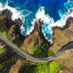
Physical mileage on Oahu rarely tells the whole story. A 20-mile trip can take twenty minutes on an open freeway or over an hour during peak commute periods. The island depends on three primary highway corridors to move between regions.
South Shore to North Shore via Central Oahu (H-1 to Route 99)
Driving from Waikīkī or downtown Honolulu to Haleiwa on the North Shore covers about 32 miles. You take Interstate H-1 west, merge onto Interstate H-2 north through Mililani, and follow Route 99 (Kamehameha Highway) through Wahiawā.
Without traffic, this drive takes 45 to 55 minutes. On weekend mornings or during winter surf competitions, coastal traffic near Laniakea Beach can easily stretch that travel time past 90 minutes.
Honolulu to Windward Coast via Trans-Koʻolau Tunnels (H-3, Pali, and Likelike)
The Koʻolau Range separates the Honolulu metropolitan area from the Windward towns of Kailua and Kāneʻohe. Three highways cut through the mountain range using tunnel systems:
- Interstate H-3: The most modern and scenic freeway route, connecting Halawa to Marine Corps Base Hawaii.
- Pali Highway (Route 61): The direct mountain pass route connecting downtown Honolulu to Kailua.
- Likelike Highway (Route 63): The primary pass connecting the Kalihi neighborhood to Kāneʻohe.
Each of these mountain routes takes only 25 to 35 minutes outside of rush hour, covering roughly 12 to 16 miles.
The Full Circle Island Loop: Distances, Pacing, and Traffic Windows
A standard scenic loop covers roughly 110 to 120 driving miles. Most travelers head east from Honolulu on Route 72 past Hanauma Bay, follow Route 83 along the Windward Coast and North Shore, and return south through the central valley on H-2.
The raw driving time for this loop is about 3.5 to 4 hours. Once you add stops for viewpoints, food trucks, and beaches, plan for a full 7 to 9 hours on the road. Eastbound morning traffic (6:00 AM to 8:30 AM) and westbound afternoon traffic (3:30 PM to 6:30 PM) on Interstate H-1 will add significant delays if you hit them.
Putting Oahu's Size in Perspective: Island and Mainland Comparisons
Comparing Oahu to familiar landmasses helps put its true scale into clear context. Oahu is compact compared to the mainland, yet it carries the highest population density in the state.
Oahu Compared to the Neighbor Islands (Big Island, Maui, Kauai)
Oahu is significantly smaller than the Big Island and Maui, but slightly larger than Kauai. Even with its smaller footprint, Oahu houses nearly one million residents, representing about 70 percent of Hawaii's total population.
| Island | Land Area (sq mi) | State Size Rank | Population Share | Character of Road Network |
|---|---|---|---|---|
| Hawaii (Big Island) | 4,028 sq mi | 1st | ~14% | Long two-lane highway loops |
| Maui | 727 sq mi | 2nd | ~11% | Valley connectors and mountain coastal roads |
| Oahu | 597 sq mi | 3rd | ~70% | High-capacity freeways and coastal routes |
| Kauai | 552 sq mi | 4th | ~5% | Single semi-circular perimeter highway |
| Molokai | 260 sq mi | 5th | <1% | Quiet two-lane rural roads |
Oahu vs. Major U.S. Cities and States (Visualizing Scale)
To picture Oahu's dimensions, consider these mainland benchmarks:
- Rhode Island: At 1,214 square miles, Rhode Island is roughly double the size of Oahu.
- Los Angeles (City Limits): The city of Los Angeles covers about 469 square miles, making Oahu roughly 27 percent larger than LA city proper.
- Houston (City Limits): Houston spans about 640 square miles, meaning the entire island of Oahu could fit inside Houston's municipal boundaries with room to spare.
- Greater London: The Greater London urban area covers roughly 607 square miles, which almost matches Oahu's total land footprint.
Island Scale and Microclimates: How 600 Square Miles Holds Five Climate Zones
Oahu's terrain creates dramatic microclimates across remarkably short distances. You can start your morning in a sunny desert landscape and drive twenty minutes into a tropical rain forest.
The Rainy Windward Coast vs. Arid Leeward Valleys
Northeast trade winds carry moist ocean air directly toward the island. When those clouds hit the 3,000-foot walls of the Koʻolau Range, the air rises, cools, and drops heavy rain over towns like Kāneʻohe and Kailua. Annual rainfall here frequently exceeds 60 to 75 inches.
Once the air passes over the ridge line, it descends and warms, leaving the western Leeward Coast (including Kapolei, Ko Olina, and Waiʻanae) dry and sunny. As of 2026, coastal resort areas on the Leeward side receive as little as 15 to 20 inches of rain annually.
Urban Honolulu Density vs. Rural Country Landscapes
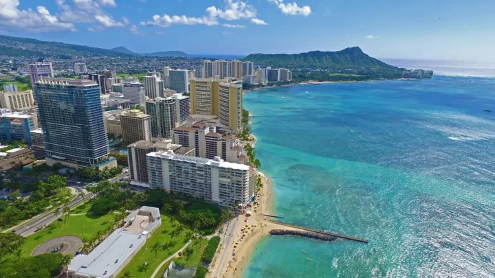
The southeastern corner of the island functions as a high-density modern metropolis. High-rise condos, business towers, and international hotels dominate the skyline from Downtown Honolulu through Waikīkī.
Drive forty minutes north past the pineapple fields of the central plain, and the environment changes completely. The North Shore and Windward communities maintain low-density residential zoning, historic plantation towns, and active farmland where two-lane roads replace multi-lane freeways.
Common Mistakes Travelers Make When Estimating Oahu's Size
Travelers often make classic route-planning errors because island maps look small on a phone screen. Recognizing these hurdles in advance keeps your itinerary realistic and stress-free.
- Assuming you can drive in a full circle: The western and northern tips do not connect. Kaʻena Point remains a protected coastal wilderness with no paved vehicle road. Trying to drive from Waiʻanae to Haleiwa requires heading back toward Pearl City first.
- Ignoring peak commute hours: A 15-mile stretch on Interstate H-1 can take fifteen minutes at midday or over an hour during rush hour. Morning traffic crawls eastbound into Honolulu, while afternoon traffic jams westbound toward Kapolei.
- Stacking opposite coastlines on the same day: Visiting Kailua Beach on the Windward Coast and catching a North Shore sunset sounds easy on paper. In practice, spending four hours in the car leaves very little time to enjoy the actual beaches.
- Relying solely on transit times from GPS apps: Navigation apps often calculate estimates based on speed limits without factoring in beach parking bottlenecks or single-lane highway construction. Add a 20-minute buffer to any cross-island trip.
Frequently Asked Questions About Oahu's Geography and Scale
How long does it take to drive around the entire island of Oahu?
A standard scenic drive around Oahu takes about 4 to 6 hours of continuous driving. The route covers roughly 110 to 120 miles along the coastline and central highway. If you plan to stop at lookout points, beaches, and food trucks, budget a full 8-hour day.
Is Oahu bigger than Maui or Kauai?
Oahu is smaller than Maui but larger than Kauai. Maui measures roughly 727 square miles, while Oahu spans 597 square miles. Kauai is slightly smaller at 552 square miles.
Oahu remains the most populous island despite ranking third in total land area.
Can you drive all the way around Oahu without stopping?
You cannot drive completely around the shoreline perimeter in an unbroken circle. The paved road ends at Kaʻena Point on both the northwest and leeward sides. Drivers must detour inland through Wahiawā and Central Oahu to move between the North Shore and the West Coast.
How many miles wide is Oahu?
Oahu measures roughly 30 miles wide at its broadest point from east to west. From the northern point at Kahuku to the southern tip near Makapuʻu, the island spans 44 miles in length. The total shoreline perimeter reaches 227 miles.
How does the size of Oahu compare to the Big Island?
Oahu is tiny compared to Hawaii Island. The Big Island covers roughly 4,028 square miles, making it nearly seven times larger than Oahu. You could easily fit Oahu inside the Big Island multiple times with plenty of room left over.

Similar Posts