How Big Is Oahu? Size, Miles & Drive Times Explained
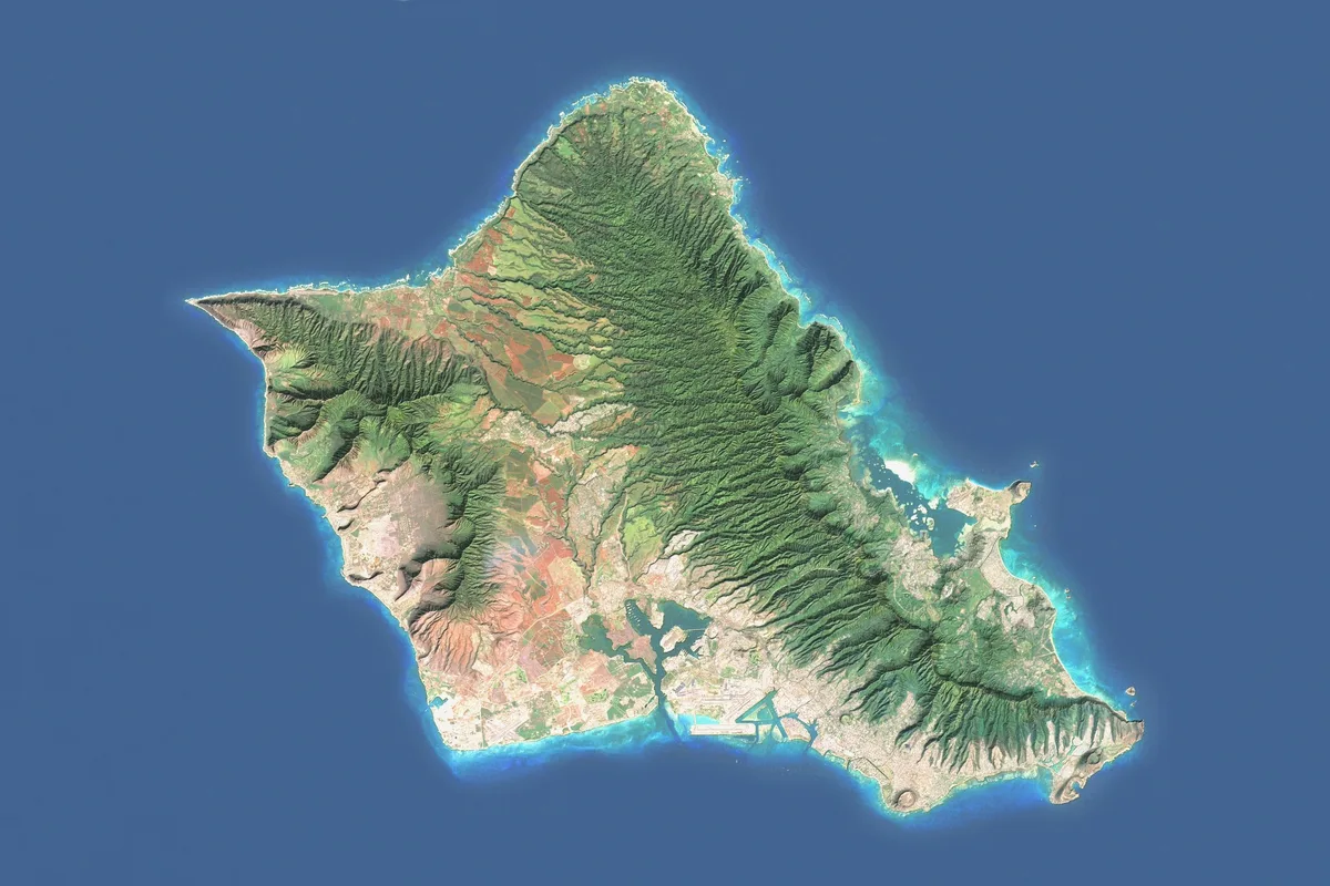
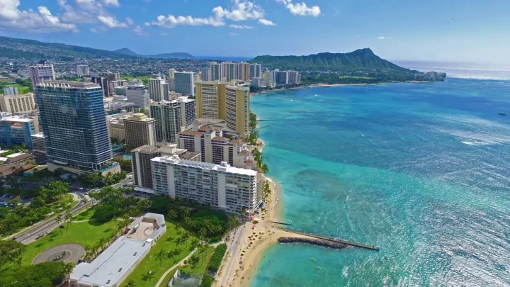
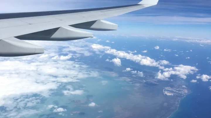
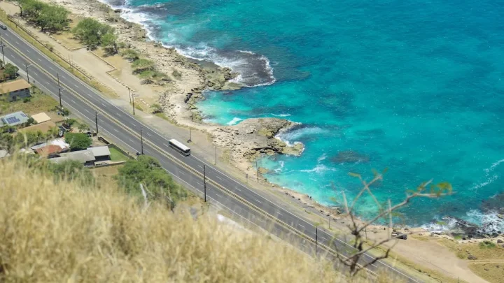
Planning a trip or mapping out a move usually starts with understanding the lay of the land. If you are wondering how big is Oahu, the answer depends on whether you measure pure acreage or real-world travel time. On paper, it looks like a compact island you can cross in an hour.
In reality, steep volcanic ridges and coastal highways create a much larger footprint.
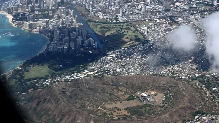
Official data from the U.S. Census Bureau puts Oahu at roughly 597 square miles of total land area. That makes it the third-largest island in the Hawaiian chain, yet it holds nearly one million residents as of 2026.
Let us look at the exact numbers and physical dimensions to see how the island actually measures up.
Image source: Bing (Web (fair-use with source credit))
Quick Answer
Oahu covers 597.2 square miles of land.
It spans 44 miles long and 30 miles wide.
The island features 227 miles of coastline.
It ranks as Hawaii's third-largest island.
Driving across takes roughly one hour without traffic.
Oahu’s Size at a Glance: Dimensions, Area, and Scale
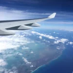
Looking at a map of the central Pacific, Oahu appears as a modest diamond-shaped landmass. In physical terms, it measures roughly 44 miles long from its northwest point to its southeastern tip. At its widest point from east to west, the distance is about 30 miles.
According to geological survey data from the U.S. Geological Survey, the total land area encompasses 597.2 square miles (1,546.7 square kilometers). The island boasts roughly 227 miles of tidal shoreline, offering an immense variety of coastal topography.
| Measurement Category | Imperial Units | Metric Units |
|---|---|---|
| Total Land Area | 597.2 sq mi | 1,546.7 km² |
| Maximum Length | 44 miles | 71 km |
| Maximum Width | 30 miles | 48 km |
| Total Shoreline | 227 miles | 365 km |
| Highest Elevation (Mount Kaʻala) | 4,025 feet | 1,227 meters |
| Second Peak (Puʻu Konahuanui) | 3,150 feet | 960 meters |
While 597 square miles sounds easy to cover, the vertical terrain changes everything. Oahu is not flat acreage. It rises sharply from sea level to over 4,000 feet, which dictates where people can build, live, and drive.
The Island's Anatomy: Visualizing Oahu's Two Mountain Ranges and Five Regions
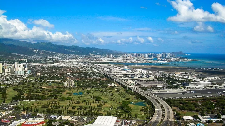
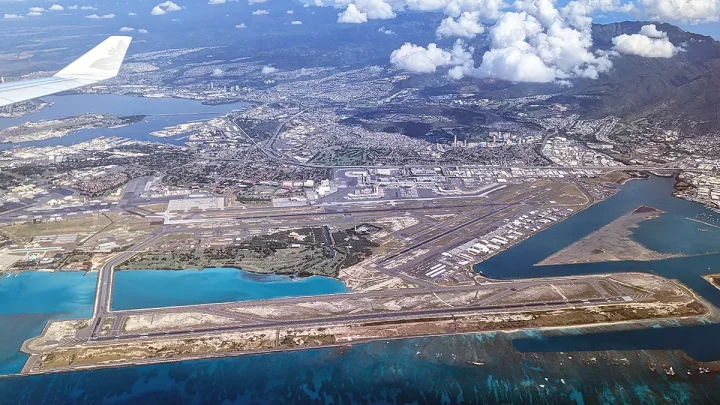
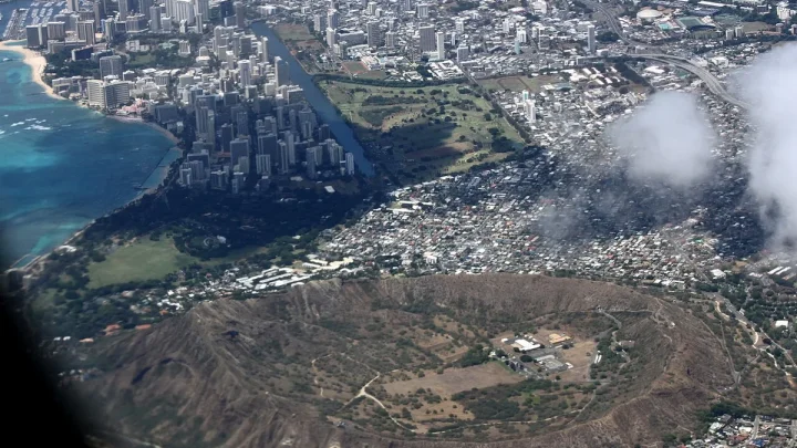
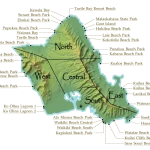
To understand Oahu's actual scale, picture two parallel mountain ranges running roughly northwest to southeast. These volcanic formations act as natural walls, dividing the island into distinct climatic zones and travel corridors.
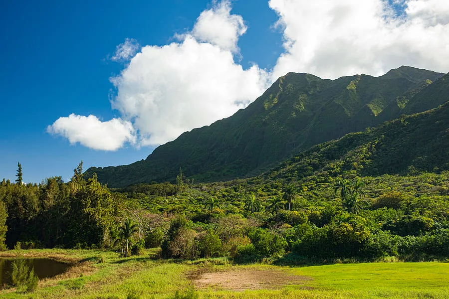
Image source: Web (Bing) / pixels.com (Web image (fair-use with source credit))
The Natural Split: Koʻolau and Waiʻanae Ranges
The older Waiʻanae Mountain Range anchors the western side of the island. It contains Mount Kaʻala, the island's tallest peak at 4,025 feet. This range creates a sharp rain shadow, making the western coast dry and sun-drenched.
The Koʻolau Mountain Range stretches along the eastern side. It features dramatic, fluted green cliffs known as the Pali. Between these two rugged ranges lies the fertile central plateau, forming a central valley that connects the north and south coasts.
The Five Key Sectors: Metro South, Windward, North Shore, Leeward, and Central
Locals break the island into five distinct geographic areas:
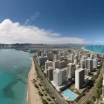
- Metro Honolulu (South Shore): Home to Waikiki, downtown business districts, and the majority of the island's population.
- Windward Coast (East): Lush, green residential towns like Kailua and Kaneohe, fed by trade wind rains hitting the Koʻolau cliffs.
- North Shore: A laid-back coastal stretch famous for big-wave surfing, farmlands, and historic Haleiwa town.
- Leeward Coast (West): Sunny resort areas like Ko Olina giving way to local communities along the dry Waiʻanae coastline.
- Central Oahu: The elevated Wahiawa plain, featuring agricultural fields, pineapple plantations, and suburban communities like Mililani.
Driving Oahu: Why You Can’t Drive in a Complete Circle
Many first-time visitors look at a map and assume they can rent a car and drive one continuous loop around the outer perimeter. That is a common planning error.
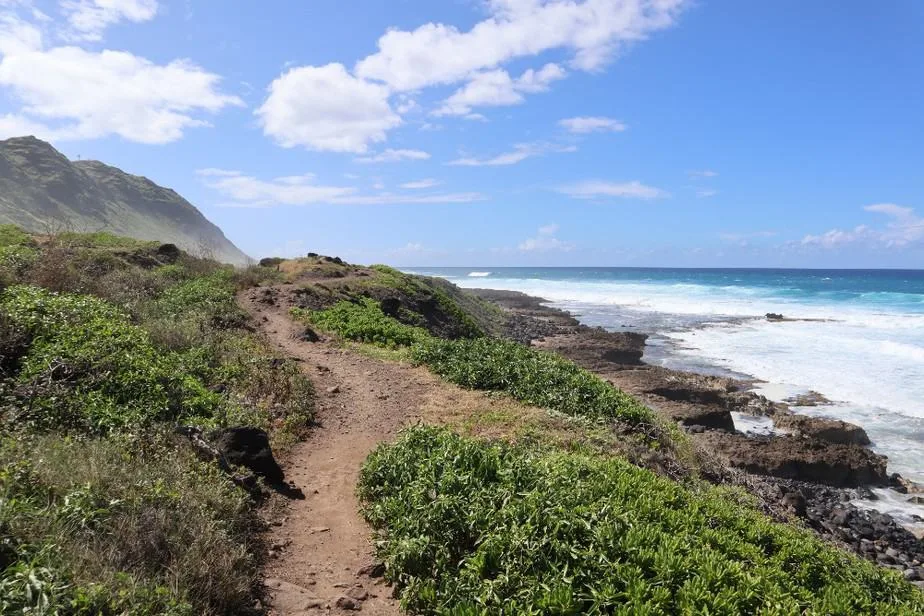
Image source: Web (Bing) / thistraveldream.com (Web image (fair-use with source credit))
The Kaʻena Point Gap: The Dead End You Need to Plan For
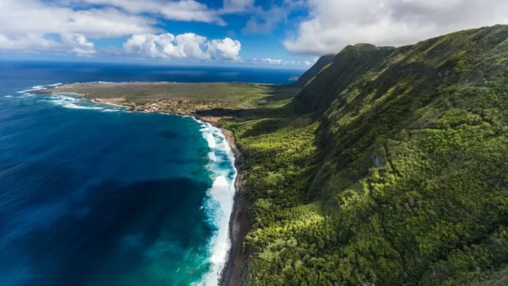
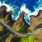
At the extreme northwestern tip of Oahu lies Kaʻena Point. This area is a protected state natural reserve featuring rugged volcanic cliffs and sand dunes. No paved road connects the northern Farrington Highway to the western Farrington Highway.
Because there is no road around Kaʻena Point, you cannot complete a full coastal circle. If you drive up the west coast, you must eventually turn around and backtrack toward Honolulu to reach the North Shore or the Windward side.
Real-World Drive Times Across the Island
Drive times on Oahu are shaped by terrain and traffic patterns rather than sheer mileage. Crossing through the mountains requires taking one of three tunnels on the Pali Highway, Likelike Highway, or Interstate H-3.
| Route Segment | Distance (Approx.) | Average Drive Time (Off-Peak) | Peak Traffic Window |
|---|---|---|---|
| Waikiki to North Shore (Haleiwa) | 32 miles | 45 to 60 minutes | 75 to 90 minutes |
| Honolulu to Kailua (Windward) | 14 miles | 25 to 30 minutes | 45 to 60 minutes |
| Honolulu to Ko Olina (Leeward) | 27 miles | 35 to 45 minutes | 60 to 90 minutes |
| North Shore to Windward Coast | 35 miles | 60 to 75 minutes | 75 to 90 minutes |
Without stops, driving the accessible coastline and cutting through the central plateau takes about four to six hours.
Oahu Compared to the Other Hawaiian Islands
Although Oahu is the economic and cultural hub of the state, it is far from the largest landmass in the archipelago. It ranks third in physical area among the main islands.
Ranking Hawaii’s Major Islands by Land Area and Population
Hawaii’s islands show a massive contrast between physical size and population density. The Big Island dominates in acreage, but Oahu holds roughly 70 percent of the state's total residents.
| Island | Land Area (Sq Miles) | Land Area (Sq Km) | State Size Rank | Approx. Population Share |
|---|---|---|---|---|
| Hawaiʻi (The Big Island) | 4,028 sq mi | 10,432 km² | 1st | ~14% |
| Maui | 727 sq mi | 1,883 km² | 2nd | ~11% |
| Oahu | 597 sq mi | 1,547 km² | 3rd | ~70% |
| Kauai | 552 sq mi | 1,430 km² | 4th | ~5% |
| Molokai | 260 sq mi | 673 km² | 5th | <1% |
| Lanai | 140 sq mi | 364 km² | 6th | <1% |
How Big Does Oahu Feel Compared to Maui, Kauai, and the Big Island?
The Big Island is nearly seven times larger than Oahu. You can fit all other main Hawaiian islands inside its borders with room to spare. Driving across the Big Island feels like an extensive road trip across lava fields and diverse ecosystems.
Maui is about 22 percent larger in land area than Oahu, but it features vast stretches of unpopulated volcanic terrain around Haleakala. Kauai is slightly smaller than Oahu, measuring 552 square miles, but its roads only trace a partial horseshoe around its perimeter.
Oahu feels larger than its square mileage suggests because of its complex road networks and distinct regional communities. You can move from high-rise city blocks to rural farming towns in under forty minutes.
Oahu vs. Familiar Mainland US Benchmarks
To help visualize Oahu’s 597 square miles, compare it to well-known cities, counties, and states on the US mainland.
Rhode Island is the smallest US state, covering roughly 1,034 square miles of actual land. Oahu is roughly 58 percent the size of Rhode Island. If you compare it to US counties, Oahu matches almost perfectly with the land area of Shelby County, Tennessee (home to Memphis).
| Geographic Benchmark | Land Area (Sq Miles) | Comparison to Oahu |
|---|---|---|
| City of Houston, TX | 640 sq mi | Roughly equal size |
| Oahu | 597 sq mi | Base Reference |
| City of Los Angeles, CA | 469 sq mi | Oahu is 27% larger |
| City of Phoenix, AZ | 517 sq mi | Oahu is 15% larger |
| Rhode Island (Land Area) | 1,034 sq mi | Oahu is ~58% of RI |
| Los Angeles County, CA | 4,058 sq mi | Oahu is ~15% of LA County |
When compared to modern urban footprints, Oahu has a total boundary roughly the size of Houston's city limits. However, only a fraction of Oahu is flat, developable land, which concentrates housing and infrastructure along the coastal plains.
Common Misconceptions About Oahu’s Geography and Travel Times
First-time visitors often assume that a 597-square-mile island is quick to cross in any direction. That assumption leads to crowded schedules and missed reservations.
One major mistake is believing you can cut across the island anywhere. The Waiʻanae Range has no public cross-island roads. If you stay in Ko Olina and want to visit Haleiwa on the North Shore, you cannot cut straight up the coast.
You must drive back toward the central valley along Interstate H-1 and Route 99, turning a 15-mile straight-line distance into a 35-mile drive.
Another common myth is that Oahu is entirely paved over with city streets. While Honolulu is a dense urban core, over half of Oahu consists of protected conservation zones and agricultural land.
Finally, do not rely solely on mainland driving instincts. A 20-mile trip on a mainland highway might take 20 minutes. On Oahu, heavily traveled two-lane roads like Kamehameha Highway along the North Shore can stretch that same distance into an hour.
Practical Tips for Navigating Oahu’s Unique Topography
Understanding the island's physical layout makes planning your days simple and stress-free. A few strategic adjustments keep you out of gridlock.
- Cluster your activities by region: Dedicate full days to specific sectors. Spend one day exploring the Windward towns of Kailua and Kaneohe, and reserve a separate day for the North Shore surf breaks.
- Time the highway tunnels carefully: If you travel between Honolulu and the Windward coast, use Interstate H-3 for speed and dramatic views. Use the Pali Highway (Route 61) for scenic lookouts, but avoid weekday afternoon rush hours heading east.
- Watch the morning and evening commute: Traffic flows heavily toward downtown Honolulu in the morning and back toward the Leeward and Central suburbs after 3:30 PM. Plan your cross-island drives in reverse of this commuter flow.
- Plan around the Kaʻena Point dead end: Remember that Farrington Highway terminates on both the west and north sides. Never plan a driving route that relies on rounding the northwest corner of the island by car.
Frequently Asked Questions About Oahu’s Size
How long does it take to drive completely around Oahu?
Driving around the accessible perimeter of Oahu takes roughly four to six hours without long stops. Heavy traffic along the two-lane North Shore corridor or through Honolulu can extend this time. Because Kaʻena Point blocks the northwest tip, you must cut across the central valley rather than driving a single continuous loop.
Is Oahu bigger than Maui or Kauai?
Oahu is smaller than Maui but slightly larger than Kauai. Maui covers 727 square miles, making it the second-largest Hawaiian island. Oahu ranks third at 597 square miles, while Kauai covers 552 square miles.
Despite its smaller physical footprint compared to Maui, Oahu holds the vast majority of the state's population.
Can you see the entire island of Oahu in one day?
You can complete a scenic circle drive in a single day, but you cannot explore every region in depth. A one-day road trip allows brief stops at major viewpoints, such as the Pali Lookout and North Shore beaches. Seeing cultural sites, hiking trails, and town centers requires three to five days.
How wide is Oahu at its narrowest point?
The narrowest section across the central plateau between Pearl Harbor on the south shore and Waialua on the north shore is roughly 11 miles wide. Driving this north-south central corridor along Interstate H-2 and Route 99 takes about 25 to 30 minutes in normal traffic conditions.
What percentage of Oahu is developed?
Less than 30 percent of Oahu is developed for urban and residential use. The remaining 70 percent consists of preserved forest reserves, steep volcanic mountain ranges, and active agricultural acreage across the central plains. Most development remains concentrated along the southern coastal plain around Metro Honolulu and the Ewa plain.

Similar Posts