Driving Across Oahu: How Long Does It Really Take?
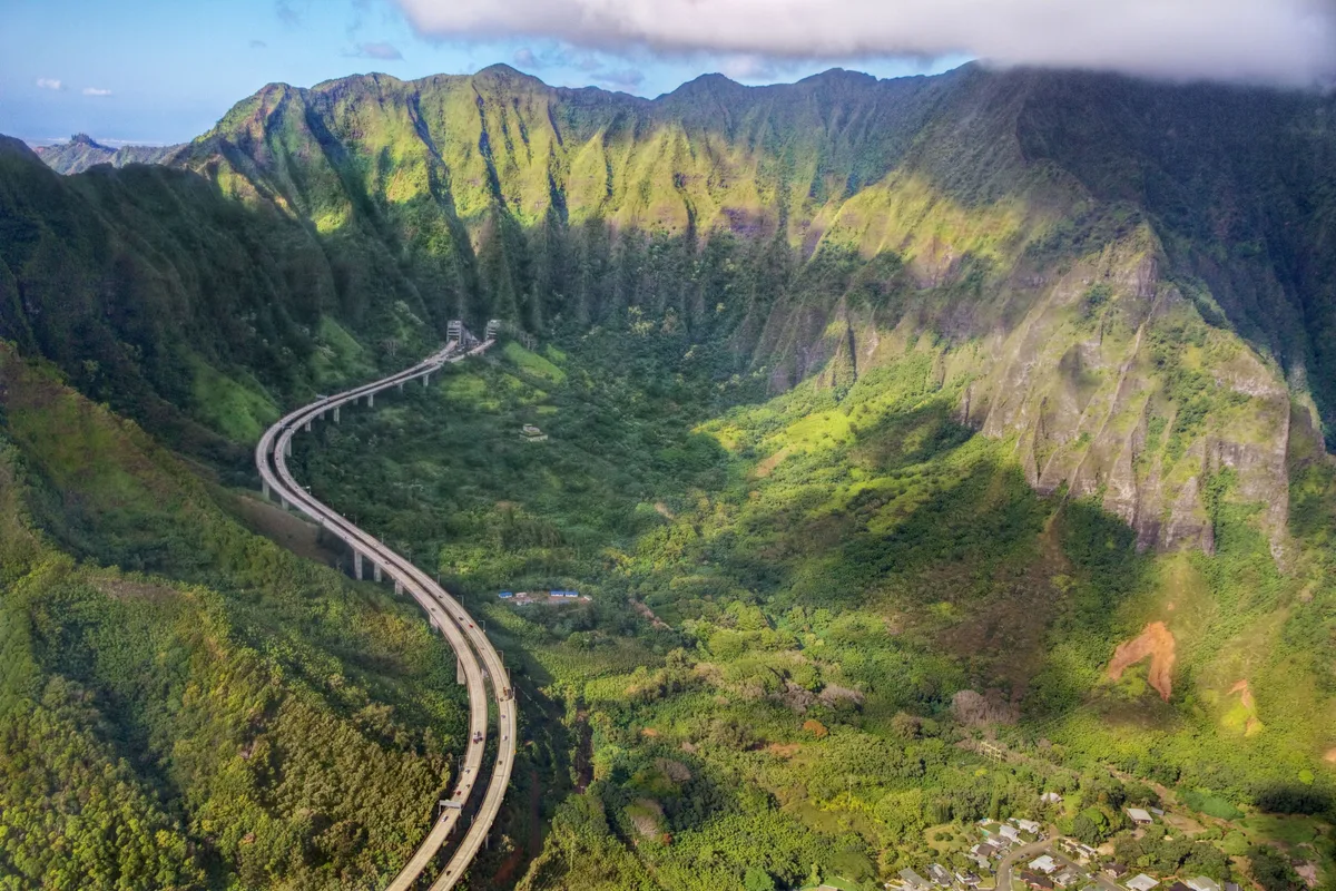
Planning an island road trip often brings up the question of how long to drive across oahu from coast to coast. The answer depends heavily on your route, the time of day, and the rugged mountain ranges that divide the island. A quick direct trip takes under an hour, while a scenic coastal loop fills an entire day.
Oahu measures roughly 44 miles long by 30 miles wide. Real-time monitoring from the Hawaii Department of Transportation shows that local highway speeds range between 25 and 60 mph. Understanding these corridors helps you plan your stops without getting stuck in island traffic.
Quick Answer
🌺 Local Island Guide Quick Answer
It takes 45 to 60 minutes to drive across Oahu directly. That route runs from Honolulu to the North Shore via Interstate H-2. A scenic east-to-west drive takes two to three hours without stops.
Heavy commuter traffic can easily double these travel times.
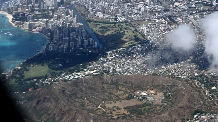
Image source: Web (Bing) / tripsavvy.com (Web image (fair-use with source credit))
How Long It Actually Takes to Drive Across Oahu
Driving across Oahu is not a simple straight line. Two major volcanic mountain ranges, the Koʻolau Range in the east and the Waiʻanae Range in the west, dictate where roads can go. Because these peaks rise sharply from the sea, highways cut through central valleys or cling directly to the shoreline.
Your total driving time changes based on the axis you choose. Driving north to south through the interior is fast and efficient. Driving east to west along the coast requires lower speeds and patience.
As of 2026, major infrastructure updates and localized road maintenance can also create temporary delays along single-lane coastal routes.
| Route Corridor | Typical Distance | Off-Peak Drive Time | Rush Hour Drive Time |
|---|---|---|---|
| Honolulu to North Shore (Direct via H-2) | 32 miles | 45–55 minutes | 75–90 minutes |
| Waikīkī to Kailua (Windward via Pali Hwy) | 15 miles | 25–35 minutes | 45–60 minutes |
| Honolulu to Ko Olina (Leeward via H-1) | 27 miles | 35–45 minutes | 70–90 minutes |
| Hawaiʻi Kai to Yokohama Bay (East to West) | 52 miles | 1.5–2 hours | 2.5–3 hours |
| Full Island Scenic Loop (Excluding Kaʻena) | 112 miles | 4.5–6 hours | 6–8 hours |
The Core Route Decision Tree: Choosing Your Trans-Island Axis
To pick the right route, you need to match your schedule with your travel goals. Use this simple decision workflow before you start your engine.
If your primary goal is reaching North Shore surf spots quickly:
- Take Interstate H-1 West out of Honolulu.
- Merge onto Interstate H-2 North at Pearl City.
- Follow Route 99 directly into Haleiwa town.
If your primary goal is coastal sightseeing and ocean lookouts:
- Take Route 72 East past Hawaiʻi Kai and Hanauma Bay.
- Continue around Makapuʻu Point toward Waimānalo.
- Follow Route 83 North along the lush Windward coastline.
If you are heading to the Windward towns of Kailua or Kāneʻohe:
- Take the Pali Highway (Route 61) for historic mountain views.
- Alternatively, take Interstate H-3 for dramatic Koʻolau tunnel views and steady freeway speeds.
The Direct North-South Run: Honolulu to the North Shore via H-2
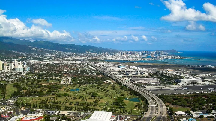
The central corridor is the fastest way to cut through the middle of Oahu. This route takes you from the urban south shore of Honolulu straight to the historic surf hub of Haleiwa. The journey spans roughly 32 miles and takes about 45 to 55 minutes in light traffic.
You begin on Interstate H-1 heading west from Honolulu. Near Waipahu, you transition onto Interstate H-2 North, climbing through the central plateau past Mililani and Wahiawā. The speed limit here reaches 55 to 60 mph on open freeway stretches.
Once H-2 ends in Wahiawā, traffic merges onto Kamehameha Highway (Route 99). The road narrows to two lanes as you descend through open agricultural fields. You will pass the Dole Plantation, where tour buses frequently slow down traffic.
From there, the highway drops gently toward the ocean, delivering you right to Haleiwa.
The Scenic East-to-West Route: Windward Coastline to Ko Olina
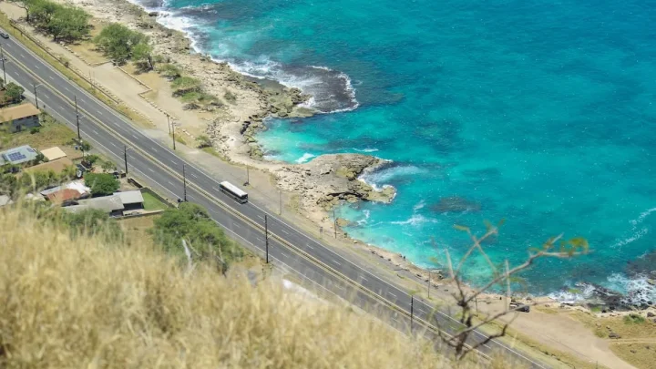
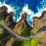
If you want ocean vistas instead of highway concrete, the cross-island coastal drive provides incredible scenery. This route connects the southeastern tip of Hawaiʻi Kai to the western resort area of Ko Olina.
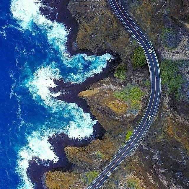
Image source: Web (Bing) / de.pinterest.com (Web image (fair-use with source credit))
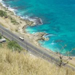
Starting on Kalanianaʻole Highway (Route 72), you hug the sea past the Halona Blowhole and Sandy Beach. The road curves around Makapuʻu Lighthouse before opening into Waimānalo. Speed limits along this stretch sit strictly between 25 and 45 mph.
From Waimānalo, you link to Kamehameha Highway (Route 83) past Kāneʻohe Bay. To complete the trip west toward Ko Olina, cut across the island on Interstate H-3 West. The Tetsuo Harano Tunnels carry you straight through the Koʻolau mountains, connecting directly to H-1 West toward Kapolei.
This drive takes about two hours of pure wheel time, but plan for three to four hours with photo stops.
The Geography Trap: Why You Cannot Drive in a Complete Circle
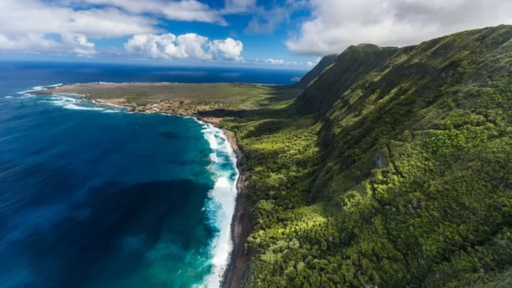
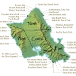
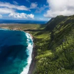
Many first-time visitors look at a map of Oahu and assume they can drive completely around the outer perimeter. That is a mistake. The extreme northwest corner of the island is blocked by the rugged wilderness of Kaʻena Point State Park.
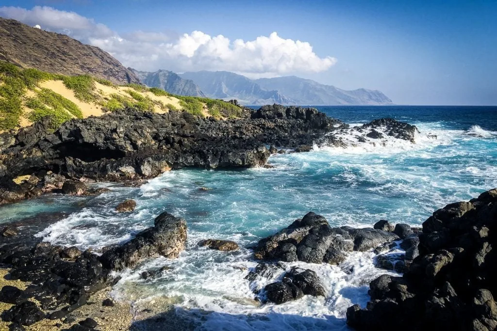
Image source: Web (Bing) / theworldtravelguy.com (Web image (fair-use with source credit))
No paved road connects the northern terminus of Farrington Highway (Route 930) near Mokulēʻia to the western terminus of Farrington Highway (Route 93) near Makua. Sharp volcanic cliffs, protected sand dunes, and nesting seabird habitats prevent road construction across the point.
If you drive up the Leeward Coast to Yokohama Bay, you must turn around and backtrack south to reach the rest of the island. Trying to force a vehicle through the unpaved conservation trails is illegal and violates standard rental car agreements. When planning a loop drive, treat Oahu as a horseshoe rather than a closed loop.
Peak Rush Hours, Surf Swells, and Local Bottlenecks to Factor In
Traffic on Oahu can turn a brief cruise into a standstill. Honolulu consistently ranks among the most congested urban areas in the United States. Knowing when and where traffic spikes helps you avoid burning vacation hours behind brake lights.
The heaviest regular congestion happens during weekday commuter hours along Interstate H-1. Traffic crawling westbound toward Kapolei and Ewa Beach peaks between 3:30 PM and 6:30 PM. Morning traffic heading eastbound into downtown Honolulu backs up from 5:30 AM to 8:30 AM.
Seasonal and recreational traffic creates distinct weekend snarls. From November through February, massive ocean swells bring international surf competitions to the North Shore. Kamehameha Highway (Route 83) between Haleiwa and Turtle Bay turns into a single-lane parking lot as crowds hunt for parking near Waimea Bay and Sunset Beach.
Pedestrian foot traffic at unmarked beach crossings slows vehicle movement to a crawl.
Localized bottlenecks also appear near major military installations during shift changes. You will encounter brief slowdowns near Joint Base Pearl Harbor-Hickam along H-1, Schofield Barracks on Route 99, and Marine Corps Base Hawaii near the eastern end of Interstate H-3.
Frequently Asked Questions About Driving Oahu
Can you drive all the way around Oahu in one day?
Yes, you can easily complete a loop drive in a single day. The drivable perimeter covers about 112 miles and takes four to six hours of pure driving time. Starting early in the morning leaves plenty of room for scenic lookouts, beach stops, and lunch.
What is the fastest highway across Oahu?
Interstate H-3 is the fastest and most efficient highway across the island. It connects Halawa in Central Oahu directly to Kāneʻohe on the Windward Coast. The highway cuts through the Koʻolau mountain range via the Tetsuo Harano Tunnels with a steady 55 mph speed limit.
Is driving on Oahu difficult for visitors?
Driving on Oahu is straightforward for most visitors. Roads are well-paved, signage is clear, and navigation apps work across the entire island. The biggest challenges are heavy freeway rush-hour traffic in Honolulu and slow-moving traffic on narrow, two-lane coastal roads.
When is the worst time to drive on Oahu?
The worst time to drive is weekday afternoon rush hour between 3:30 PM and 6:30 PM along westbound H-1. Weekend midday traffic along the North Shore during winter surf season is equally congested, often doubling standard drive times.
The Optimal Driving Itinerary: A Local’s Practical Decision Guide
To make the most of your drive across Oahu, sequence your route to work with traffic patterns rather than fighting them. A clockwise loop is generally the most efficient choice for a full-day road trip starting from Waikīkī or Honolulu.
Follow this workflow to maximize your time on the road:
- Leave your hotel by 7:30 AM to beat the morning rush heading into Honolulu.
- Head east on Kalanianaʻole Highway (Route 72) to catch the morning light at the Halona Blowhole and Makapuʻu Point.
- Follow Route 83 north along the Windward Coast, passing through Kualoa and Laie before lunchtime.
- Arrive on the North Shore by early afternoon for lunch in Haleiwa or at the Kahuku shrimp trucks.
- Return south toward Honolulu via Interstate H-2 and H-1 between 1:30 PM and 3:00 PM, beating the westbound afternoon commuter wave.
If you get a late start after 10:00 AM, flip your plan. Take H-1 to H-2 directly north to Haleiwa first, explore the North Shore during the day, and take the scenic Windward coast south in the late afternoon. This strategy keeps you moving against the heaviest commuter flows all day long.
🚗 Field-Tested Gear: Oahu Road Trips & Rental Car Protection
Avoid costly rental car detailing penalties from wet sand and keep navigation seamless across island mountain corridors with these road trip essentials:
- Waterproof Neoprene Car Seat Towel Covers:Check Waterproof Rental Seat Covers on Amazon →
- Magnetic Air Vent Car Phone Mount & GPS Companion:Check Travel Air Vent Car Mounts on Amazon →
*FTC Disclosure: As an Amazon Associate, Hawaii Travel Bureau earns from qualifying purchases. Learn more about our field-tested travel research methodology.*
🌺 Related Oahu Driving & Transit Guides:

Similar Posts