What Is the Highest Point on Oahu? Meet Mount Kaala
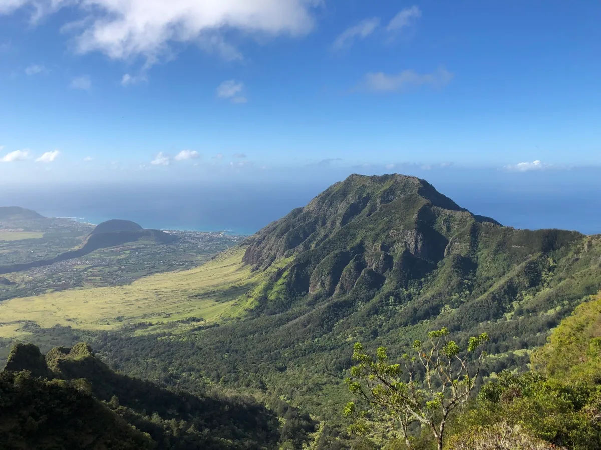
If you are looking to find what is the highest point on Oahu, you need to look west toward the Waiʻanae Mountain Range. Many visitors assume the jagged Koʻolau peaks behind Honolulu hold the island record. The true geographic summit belongs to an ancient volcanic peak called Mount Kaʻala.
According to official U.S. Geological Survey records, this western peak reaches an elevation of exactly 4,025 feet (1,227 meters) above sea level. Reaching or viewing this unique landmark requires understanding its distinct terrain and protected status as of 2026.
Image source: Web (Bing) / touristsecrets.com (Web image (fair-use with source credit))
Quick Answer
🌺 Local Island Guide Quick Answer
Mount Kaʻala is the highest point on Oahu. It stands at 4,025 feet above sea level. The peak sits in the Waiʻanae Mountain Range.
It features a rare native cloud forest bog. Civilian access by car is strictly prohibited. Hikers can only reach the summit on foot.
Mount Kaʻala: The True Roof of Oahu
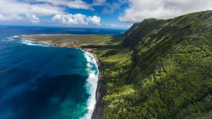
Mount Kaʻala stands out clearly from the Central Oahu plain and the Leeward coast. It is the eroded remnant of the ancient Waiʻanae shield volcano, which formed roughly 3.9 million years ago. Because it is much older than the eastern Koʻolau Range, millions of years of rainfall have carved deep valleys into its flanks.
Unlike the sharp, razor-thin ridgelines common across the rest of Oahu, the summit of Kaʻala is remarkably flat. It forms a high-elevation plateau covering roughly one square mile. Thick cloud cover blankets this tableland on most afternoons, creating a unique microclimate that traps moisture year-round.
This constant mist supports a rare montane wet forest. Deep organic peat, native mosses, and stunted trees cover the ground. The mountain acts as a massive natural water catchment for the valleys below, filtering rainfall down into the island aquifer.
How Mount Kaʻala Compares to Other Famous Oahu Summits
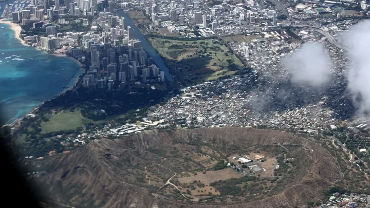
Visitors often confuse Oahu's mountain ranges. The Koʻolau Range borders Honolulu and Waikiki, making it the most visible ridge on the island. However, the Waiʻanae Range on the west side is significantly taller.
| Mountain Peak | Mountain Range | Elevation (Feet) | Elevation (Meters) | Primary Access Type |
|---|---|---|---|---|
| Mount Kaʻala | Waiʻanae Range | 4,025 ft | 1,227 m | Strenuous ridge hike |
| Puʻu Kalena | Waiʻanae Range | 3,504 ft | 1,068 m | Restricted / technical ridge |
| Kōnāhuanui (Peak 1) | Koʻolau Range | 3,150 ft | 960 m | Advanced trail hike |
| Puʻu Ohulehule | Koʻolau Range | 2,265 ft | 690 m | Advanced scramble |
| Olomana (Peak 1) | Windward Lowlands | 1,643 ft | 501 m | Technical ridge scramble |
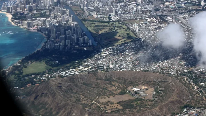
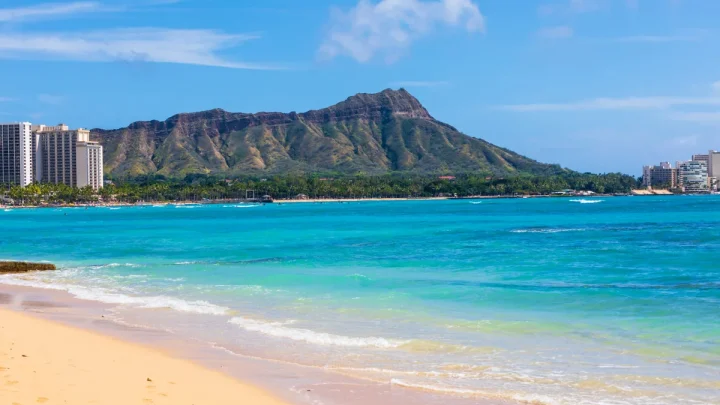
| Diamond Head (Lēʻahi) | Honolulu Volcanic Series | 761 ft | 232 m | Paved recreational path |
Mount Kaʻala rises nearly 900 feet higher than Kōnāhuanui, the highest point in the Koʻolau Range. While popular peaks like Diamond Head or Olomana provide steep climbs, they sit at a fraction of Kaʻala's true vertical elevation.
How Do You Experience the Peak? (Decision Workflow)
How you choose to view or climb Mount Kaʻala depends entirely on your physical conditioning, weather windows, and travel goals.
Start: How do you want to experience Oahu's highest peak?
 │
 ├── Option 1: Sightseeing by vehicle or scenic lookout
 │    └── Decision: Drive to Kolekole Pass or Kaʻena Point State Park.
 │         └── Result: View the massive peak safely from below.
 │
 ├── Option 2: Casual day hiker or beginner trekker
 │    └── Decision: Choose lower-elevation trails like Aiea Loop or Makapuʻu.
 │         └── Result: Avoid dangerous technical scrambles and extreme mud.
 │
 └── Option 3: Advanced hiker seeking the geographic summit
      └── Step 1: Check Leeward and summit wind and rain forecasts.
      └── Step 2: If dry, take the Waianae Valley Trail on foot.
      └── Step 3: Scramble fixed ropes to the summit boardwalk.
If you only want a scenic photo, view the peak from the North Shore beaches near Mokulēʻia or from the Leeward coastline in Waiʻanae. The summit road is restricted, so you cannot drive to the top.
If your goal is standing on the highest geographic point, you must prepare for a demanding backcountry ascent. Choose a clear day with low rainfall predictions to avoid slick, dangerous mud along the upper ropes.
The Summit Route: Navigating the Waianae Valley Trail to the Plateau
The primary legal route to the summit is the Waianae Valley Trail, also known as the Mount Kaʻala Trail. This out-and-back trek covers approximately 7 miles round trip and demands over 3,300 vertical feet of continuous climbing.
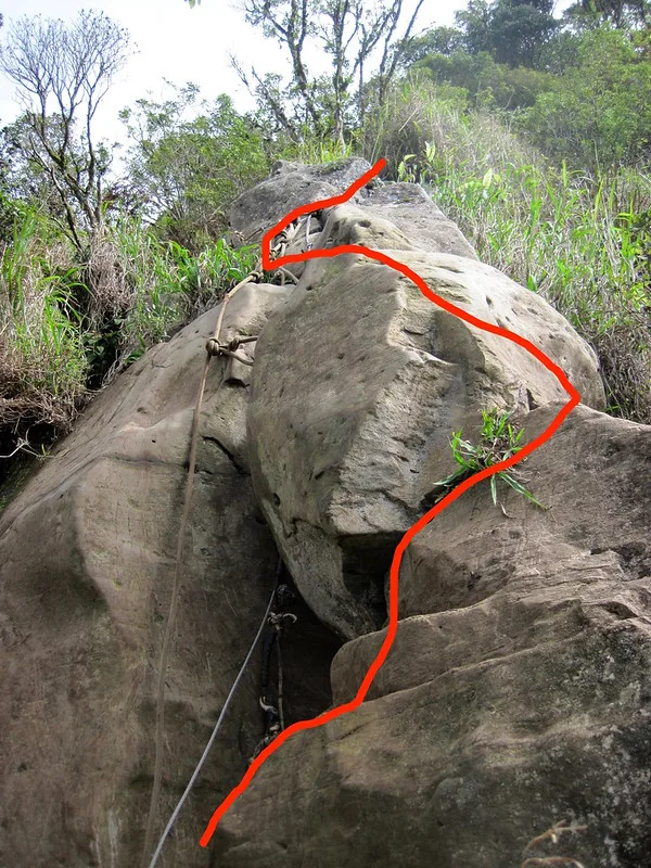
Image source: Bing (Web (fair-use with source credit))
The journey breaks down into three distinct stages:
- The Lower Access Road: You begin past the vehicle gate at the end of Waianae Valley Road. The first mile follows a paved service road through hot, exposed terrain surrounded by non-native kiawe forest.
- The Forest Ridge: After turning onto the dirt trail, the path climbs aggressively through guava groves and rocky switchbacks. The humidity here is usually intense during morning hours.
- The Upper Rope Scramble: The final 1,000 feet of elevation gain requires climbing nearly vertical basalt rock faces. Hikers must haul themselves up narrow chutes using fixed ropes anchored into rock and tree roots.
Reaching the crest brings an immediate change in climate. The hot, dry air of Waiʻanae Valley gives way to cold mist and damp winds along the plateau rim.
Inside the Summit: The FAA Radome and Native Cloud Bog
Stepping onto the top of Mount Kaʻala brings you into the protected Mount Kaʻala Natural Area Reserve, established under the authority of the Hawaii Department of Land and Natural Resources. This high-altitude bog preserves ancient native ecosystems that have vanished from lower elevations.
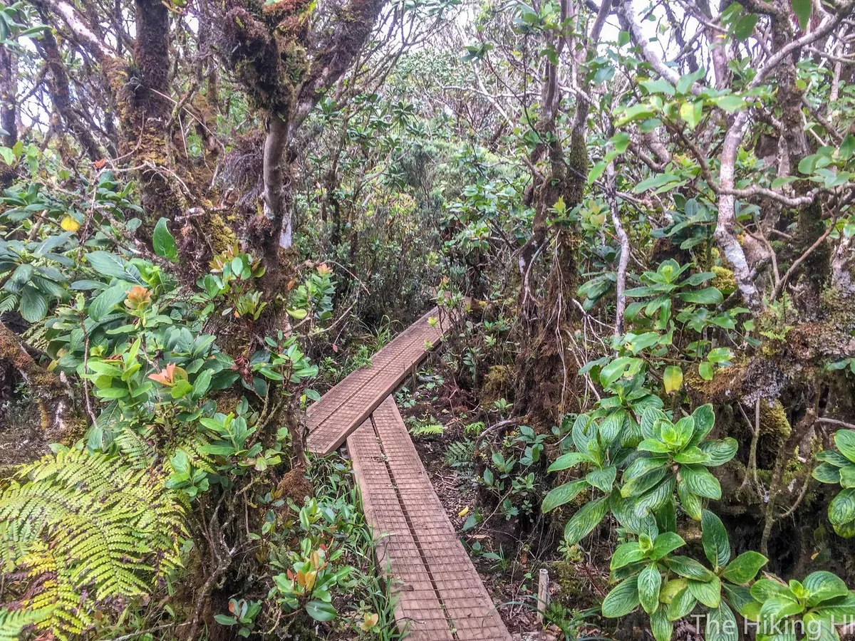
Image source: Web (Bing) / thehikinghi.com (Web image (fair-use with source credit))
To protect this fragile ground, the state maintains an elevated wooden boardwalk through the cloud forest. You must stay on the wooden planks at all times. Walking into the bog destroys delicate sphagnum moss beds and damages root networks of ancient ʻōhiʻa lehua trees.
Two contrasting worlds meet at the top:
- The Native Cloud Bog: Home to rare Hawaiian plants like lapalapa and native ferns, along with endangered yellow-faced bees and historic tree snail populations.
- The FAA Radar Station: A large white geodesic dome structure (an active Air Route Surveillance Radar operated jointly by the Federal Aviation Administration and the military) sits at the edge of the plateau.
The radar facility is surrounded by heavy security fences and warning signs. Hikers must respect all boundaries, as entering the installation grounds is a federal violation.
Critical Safety, Gear, and Legal Realities Before You Go
Climbing Mount Kaʻala requires preparation for two completely different environments in a single day. You will start in a hot, dry lowland valley and finish in a cold, rain-soaked cloud bog.
Aggregate trail safety reports emphasize bringing the right gear for steep mud. You will need shoes with aggressive tread or trail spikes, along with sturdy grip gloves for handling wet, mud-coated ropes. Pack at least three to four liters of water per person, as the lower valley heats up quickly.
Bring a light rain jacket and a dry warm layer for the cold summit.
Biosecurity is another vital requirement. The summit bog contains rare native plants vulnerable to invasive species and fungal diseases like Rapid ʻŌhiʻa Death. Brush all dirt and seeds off your boots before starting the trail, and stay strictly on the wooden boardwalk once you reach the summit plateau.
Common Mistakes Hikers Make on Mount Kaʻala
The most frequent error is underestimating the physical toll of the rope sections. The upper ridge involves sustained upper-body pulling on nearly vertical rock walls. If your arms fatigue early, the descent becomes significantly more dangerous on the return trip.
Hikers also make several common logistical mistakes:
- Trusting fixed ropes blindly: Ropes on the ridge are placed by previous hikers, not park rangers. Always test anchors and inspect lines for fraying before placing your full body weight on them.
- Attempting to drive up: GPS navigation apps sometimes route drivers onto the paved service road near Wahiawa. This road passes through military land and is strictly closed to the public behind locked gates.
- Leaving valuables in vehicles: The trailhead at the end of Waianae Valley Road has a history of break-ins. Leave nothing of value in your car, and keep the interior completely clear.
- Stepping off the boardwalk: Walking off the summit path directly into the moss causes long-term damage to fragile endemic ecosystems that take decades to recover.
Frequently Asked Questions About Oahu’s Highest Point
Can you drive to the top of Mount Kaʻala?
No, you cannot drive to the summit. The paved road running up from Central Oahu is a private access route restricted to active military and FAA personnel. Civilian vehicles and unauthorized pedestrians are stopped at locked security gates.
How long does it take to hike Mount Kaʻala?
Most experienced hikers take between 5 and 7 hours to complete the round trip. The hike is only 7 miles long, but the steep 3,300-foot vertical gain and technical rope sections slow down your pace considerably.
Is Mount Kaʻala higher than Diamond Head?
Yes, Mount Kaʻala is significantly higher than Diamond Head. Diamond Head stands at an elevation of 761 feet along the southern shore. Mount Kaʻala reaches 4,025 feet in the western Waiʻanae Range, making it more than five times taller.
What is at the top of Mount Kaʻala?
The summit holds an active FAA radar tracking dome alongside a protected native cloud forest. A state-maintained wooden boardwalk cuts across the flat plateau bog, allowing hikers to view rare native Hawaiian vegetation safely without damaging the fragile ecosystem.
Do you need a permit to hike Mount Kaʻala?
You do not need a recreational permit for day hiking along the standard Waianae Valley Trail to the summit plateau. However, you must stay within public trail boundaries and avoid entering the fenced federal radar station grounds.
🥾 Field-Tested Gear: Hawaii Trail & Sightseeing Protection
From rugged Kualoa filming valleys to sharp volcanic ridgelines, tackle Oahu’s premier attractions safely with trail-proven footwear and sun protection:
- High-Traction Breathable Water Hiking Shoes:Check Quick-Dry Water Hiking Shoes on Amazon →
- UPF 50+ UV Sun Protection Long-Sleeve Rash Guard:Check UPF 50+ Sun Protection Shirts on Amazon →
*FTC Disclosure: As an Amazon Associate, Hawaii Travel Bureau earns from qualifying purchases. Learn more about our field-tested travel research methodology.*
🌺 Related Hawaii Sights, Culture & Filming Guides:

Similar Posts