Where Is Oahu, Hawaii on the Map? Island Location Guide
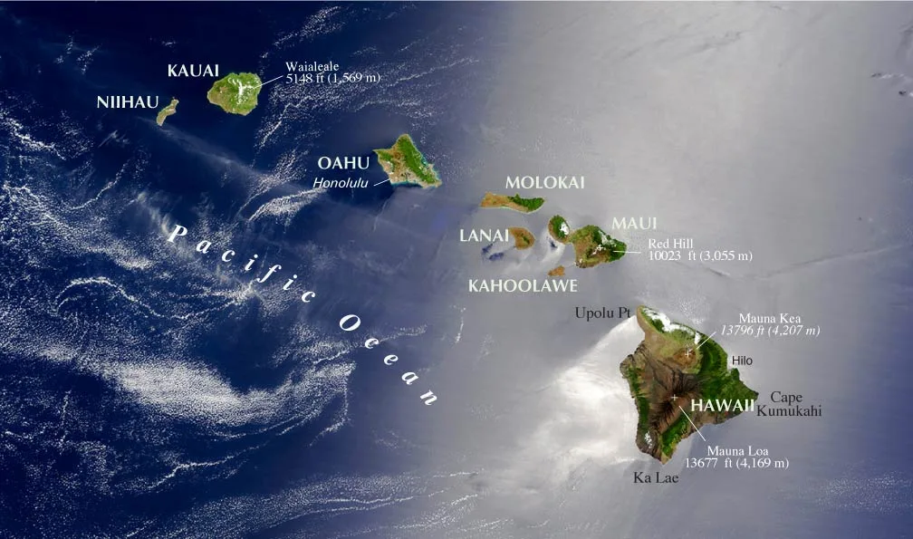
If you pull up a world map, finding the Hawaiian islands can feel like searching for tiny dots in a massive blue void. Knowing exactly where is oahu hawaii on the map makes planning your trip, booking flights, and understanding local travel times much easier.
Oahu sits right in the heart of the North Pacific Ocean as the cultural and commercial hub of Hawaii. Cartographic data from the U.S. Geological Survey places the island roughly 2,400 miles southwest of the continental United States, serving as the central anchor for the entire archipelago.
Image source: Bing (Web (fair-use with source credit))
Quick Answer
🌺 Local Island Guide Quick Answer
Oahu sits in the central North Pacific Ocean. It is the third largest Hawaiian island. You will find it southeast of Kauai and northwest of Maui.
It lies roughly 2,400 miles southwest of California. Oahu contains Honolulu, the state capital of Hawaii.
Where Oahu Sits on the World Map: Coordinates and Global Context
To spot Oahu on a global map, look directly at the northern central region of the Pacific Ocean. It rests well above the equator and just below the Tropic of Cancer. This puts the entire island firmly within the global tropics, which explains its warm climate year-round.
Pinpointing Oahu in the Central Pacific
Oahu is isolated from major continental landmasses. It forms the northern point of the Polynesian Triangle, which stretches down to New Zealand and east to Easter Island.
When you look at the Pacific basin, Oahu sits roughly midway between North America and East Asia. This unique position makes it a historic crossroads for transpacific shipping lanes and global aviation routes.
Exact Geographic Coordinates and Flight Distances
Geographic navigation tools place the center of Oahu at approximately 21.4389° N latitude and 158.0001° W longitude.
Long flights are standard when traveling to Oahu. Here is how far the island sits from key coastal hubs around the Pacific Rim:
- Los Angeles, California: 2,550 miles (5.5 to 6 hours direct)
- San Francisco, California: 2,400 miles (5.5 hours direct)
- Seattle, Washington: 2,680 miles (6 hours direct)
- Tokyo, Japan: 3,850 miles (7.5 to 8.5 hours direct)
- Sydney, Australia: 5,060 miles (10 hours direct)
Finding Oahu Within the Hawaiian Island Chain
Hawaii is an archipelago made of eight main islands stretching across hundreds of miles of open water. Oahu is the focal point of this chain, both in terms of population and transportation infrastructure.
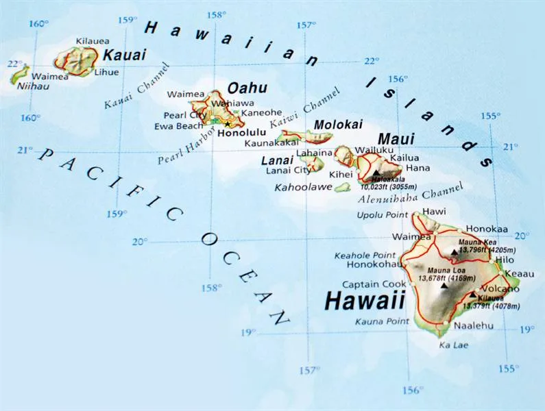
Image source: Bing (Web (fair-use with source credit))
Oahu's Position Relative to Neighbor Islands
If you scan the island chain from northwest to southeast, Oahu is the third major populated island you encounter.
To the northwest across open water lies Kauai, known as the Garden Isle, alongside its small neighbor Niihau. Looking southeast, you will spot Molokai, Lanai, Maui, and Kahoʻolawe. Further southeast sits the massive Island of Hawaii, commonly called the Big Island.
| Island | Direction from Oahu | Approximate Channel Width |
|---|---|---|
| Kauai | Northwest | 72 miles (Kaʻieʻie Waho Channel) |
| Molokai | Southeast | 26 miles (Kaiwi Channel) |
| Maui | East-Southeast | 80 miles (across Molokai/channels) |
| Hawaii Island | Far Southeast | 170 miles (open ocean passage) |
Major Ocean Channels Framing the Island
Two major deep-water ocean channels separate Oahu from its nearest neighbors.
The Kaʻieʻie Waho Channel sits to the northwest between Oahu and Kauai. It is one of the widest and roughest open-water passages in the state.
To the southeast, the Kaiwi Channel separates Oahu from Molokai. Ocean swells push heavily through these passages, making them famous for world-class outrigger canoe paddling and deep-sea navigation.
Reading the Map of Oahu: Key Regions, Shores, and Landmarks
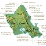
Oahu covers roughly 597 square miles and measures about 44 miles long by 30 miles wide. The island is divided into distinct geographic regions, each with its own landscape and vibe.
       [ North Shore: Haleiwa, Waimea ]
                     /\
[ Leeward Coast ]   /  \   [ Windward Coast ]
  Ko Olina         /    \    Kailua, Kaneohe
  Waianae         / Cen. \
                  \Plain /
                   \    /
                    \  /
         [ South Shore: Honolulu, Waikiki ]
South Shore: Urban Honolulu and Waikiki
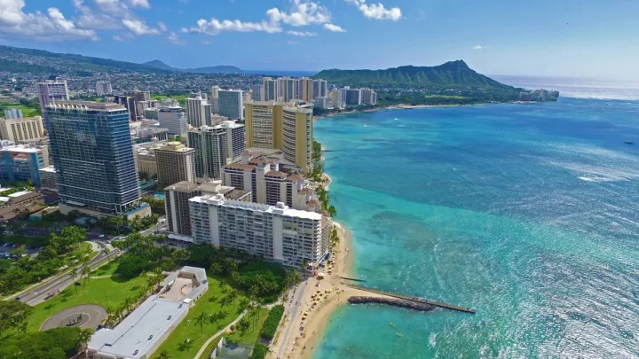
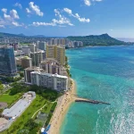
The South Shore is the bustling heart of the state. This coast includes Honolulu, the state capital, as well as the world-famous resort strip of Waikiki.
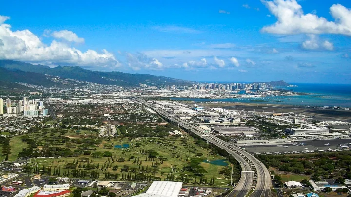
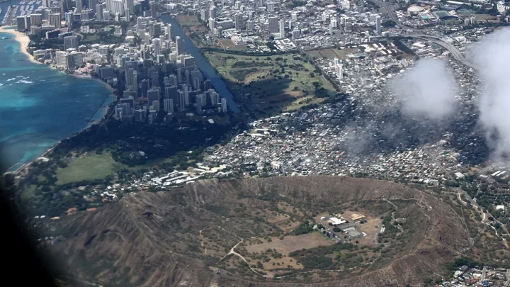
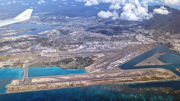
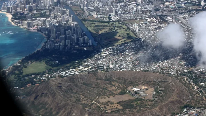
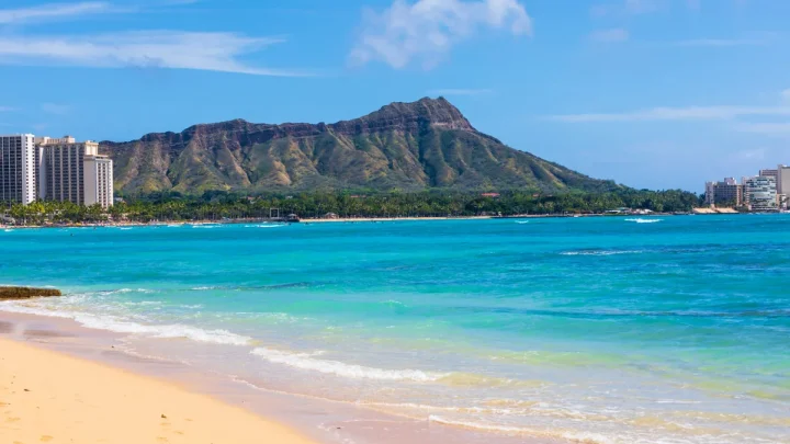
Here you will find Daniel K. Inouye International Airport, the natural inlet of Pearl Harbor, and the volcanic crater of Diamond Head. Most visitors land here and use the south coast as their home base.
Windward Coast: The Lush Eastern Flank
The eastern side of the island is known as the Windward Coast. This coastline faces the prevailing trade winds coming off the ocean, capturing heavy rainfall along the cliffs.
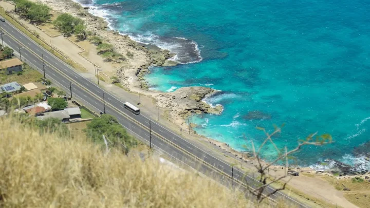
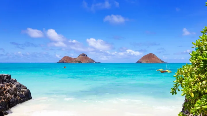
Towns like Kailua and Kaneohe sit here. The region is famous for bright turquoise waters, dramatic green mountain backdrops, and soft sand beaches like Lanikai.
North Shore: Global Surfing Capital
The North Shore stretches along the top curve of Oahu. Centered around the historic surf town of Haleiwa, this coast features world-famous surf breaks like Pipeline, Sunset Beach, and Waimea Bay.
During winter, massive North Pacific ocean swells hit these beaches, drawing competitive surfers from around the globe.
Leeward Coast and Central Valley
The Leeward Coast lines the dry western edge of the island, home to communities like Kapolei, Ko Olina, and Waianae. Protected from rain clouds by mountains, it receives abundant sunshine.
Between the eastern and western mountain ranges lies the Central Oahu Plain. This elevated plateau holds suburban neighborhoods like Mililani and historic agricultural towns like Wahiawa.
Topography and Orientation: Understanding Mountain Ranges and Microclimates
Oahu was formed by two separate shield volcanoes that eroded over millions of years. This unique volcanic past shapes how roads run and how weather moves across the island.
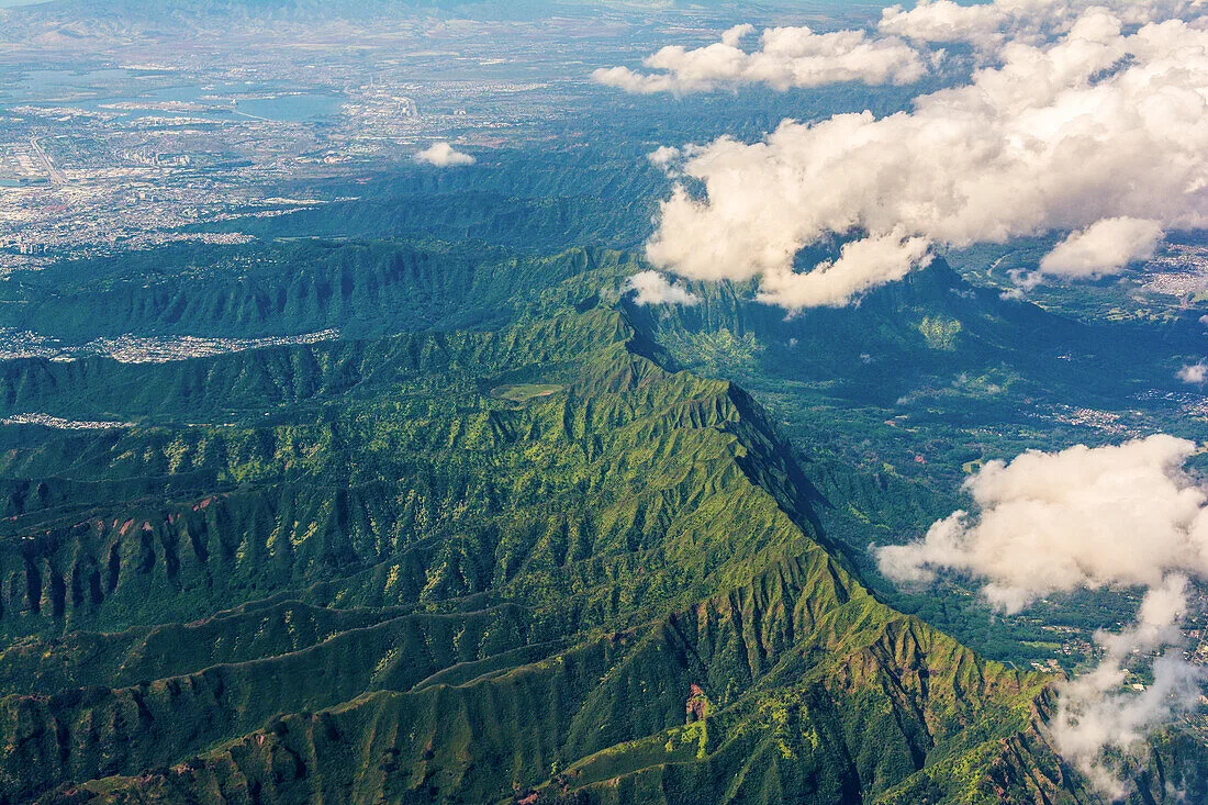
Image source: Bing (Web (fair-use with source credit))
The Dual Mountain Spines: Koʻolau vs. Waiʻanae
Two primary mountain ranges run parallel down the island, creating natural barriers between the coasts.
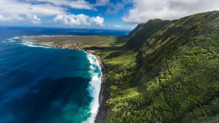
The Koʻolau Range forms a jagged ridge along the eastern side. Its steep, fluted green cliffs block moisture from the northeast trade winds.
The Waiʻanae Range runs along the western coast. It is older and taller, featuring Kaʻala, the highest peak on Oahu at 4,025 feet. Highways cannot cross straight through these mountains, so traffic routes loop around the coastlines or cut through the central plain.
Navigating by Mauka and Makai
Locals rarely use compass points like north or south when giving driving directions on Oahu. Instead, you will hear directional terms based on landscape landmarks.
- Mauka (MOW-kah): Toward the mountains. No matter where you stand on the island, turning toward the mountain ridges means you are facing mauka.
- Makai (mah-KYE): Toward the ocean. Turning toward the sea means you are facing makai.
- Diamond Head / Koko Head: Used in Honolulu to mean traveling eastward toward the craters.
- Ewa (EH-vah): Used in Honolulu to mean traveling westward toward the Ewa plain.
Common Map-Reading Mistakes When Planning a Hawaii Trip
Navigating Hawaiian geography can confuse first-time visitors looking at online maps or travel brochures. Avoiding a few common map-reading mistakes will save you time and frustration.
Confusing Oahu with "The Big Island" of Hawaii
The most frequent mix-up is confusing the island of Oahu with the island of Hawaii.
The state is named Hawaii, but the largest physical landmass in the chain is Hawaii Island, known locally as the Big Island. Oahu is only the third largest island by area, yet it houses roughly 70 percent of the state's total population. Active volcanoes like Kilauea are on the Big Island, not on Oahu.
Treating Honolulu and Waikiki as Separate Islands
Travel itineraries sometimes list Honolulu, Waikiki, and Oahu as if they were three different destinations.
Honolulu is the major city covering the south shore of Oahu. Waikiki is simply a specific beachfront neighborhood inside the city limits of Honolulu. When you fly into Honolulu or stay in Waikiki, you are physically on the island of Oahu.
Misjudging Inter-Island Distances and Travel Times
Do not expect to take a quick road trip or bridge across to neighboring islands like Maui or Kauai.
No bridges or public car ferries connect the Hawaiian islands. Moving between Oahu and other islands requires booking an inter-island flight. These commercial flights take about 30 to 45 minutes of air time, plus standard airport check-in periods.
Essential Geographic Specs and Map Reference Guide
Understanding Oahu's physical layout helps you calculate realistic travel itineraries and plan daily driving routes. The island is compact compared to continental landmasses, but mountainous terrain funnels all traffic through specific highway corridors.
Oahu Key Data at a Glance
Our research into state cartographic records outlines the key physical and structural benchmarks for the island.
| Measurement / Metric | Official Specification |
|---|---|
| Land Area | 597.3 sq miles (1,547 km²) |
| Coastline Length | 227 miles (365 km) |
| Maximum Elevation | 4,025 feet (Mount Kaʻala) |
| County Seat & Capital | Honolulu |
| Primary Airport | Daniel K. Inouye International (HNL) |
| Time Zone | Hawaii-Aleutian Standard Time (UTC-10) |
| Daylight Saving Time | Not observed (as of 2026) |
Pro Tips for Navigating the Island Once You Arrive
Driving around Oahu requires watching the clock and knowing the key freeway corridors. Interstate H-1 runs east to west across the southern urban corridor, linking the airport to downtown Honolulu and Waikiki.
If you plan to visit the Windward side, you will cross the mountains using one of three scenic routes: the Pali Highway (Route 61), the Likelike Highway (Route 63), or the H-3 Freeway.
Heading to the North Shore requires taking Interstate H-2 north through the central plateau toward Wahiawa, then dropping down Kamehameha Highway (Route 99) straight into Haleiwa.
Traffic bottlenecks build heavily during weekday rush hours coming out of downtown Honolulu toward the west side.
Frequently Asked Questions About Oahu’s Map Location
What ocean is Oahu located in?
Oahu is located in the North Pacific Ocean. It sits in the Polynesian sub-region of Oceania, roughly 2,400 miles southwest of the United States mainland.
Is Honolulu the same thing as Oahu?
Honolulu is the primary city located on the southeast shore of Oahu, not a separate island. Oahu is the name of the entire island, while Honolulu serves as its urban center and state capital.
How long does it take to drive around the whole island of Oahu?
Driving around Oahu takes roughly four to five hours without extended stops. You cannot drive completely around the northwest tip (Kaʻena Point) because no paved roads cross that protected wilderness reserve.
Which Hawaiian islands are closest to Oahu?
Molokai is the closest island to the southeast, separated by the 26-mile-wide Kaiwi Channel. Kauai is the closest neighbor to the northwest, located 72 miles away across the Kaʻieʻie Waho Channel.
Where is Pearl Harbor on the Oahu map?
Pearl Harbor sits on the southern coast of Oahu. It is located just west of Honolulu and Daniel K. Inouye International Airport, along the shoreline of the Ewa district.
🚗 Field-Tested Gear: Oahu Road Trips & Rental Car Protection
Avoid costly rental car detailing penalties from wet sand and keep navigation seamless across island mountain corridors with these road trip essentials:
- Waterproof Neoprene Car Seat Towel Covers:Check Waterproof Rental Seat Covers on Amazon →
- Magnetic Air Vent Car Phone Mount & GPS Companion:Check Travel Air Vent Car Mounts on Amazon →
*FTC Disclosure: As an Amazon Associate, Hawaii Travel Bureau earns from qualifying purchases. Learn more about our field-tested travel research methodology.*
🌺 Related Oahu Driving & Transit Guides:

Similar Posts